Nick MacKinnon is a freelance teacher of Maths, English and Medieval History, and lives above Haworth, in the last inhabited house before Top Withens = Wuthering Heights. In 1992 he founded the successful Campaign to Save Radio 4 Long Wave while in plaster following a rock-climbing accident on Skye. His poem ‘The metric system’ won the 2013 Forward Prize. His topical verse and satire appears in the Spectator, and his puzzles and problems in the Sunday Times and American Mathematical Monthly. Email: nipmackinnon@gmail.com
Crow Hill to Alcomden Stones SD 96375 36265 ///teacher.testy.hulk

27 May 2026 The Yorkshire heatwave ended yesterday, and tomorrow lightning falls, so today is the long awaited traverse from Crow Hill to Alcomden Stones across Stanbury Bog. Donald Mackay, the CEP engineer, proposes a floating road there. Because I don’t believe the northern infrastructure will survive to the DCO application, it is all shown in green in the map above. The green track is mostly floating on a cushion of peat between two and five metres deep, so it won’t create any spoil; the trouble is, they don’t want to dig out turbine foundations on the very deep peat where the floating track goes, so the track is superfluous. The turbines have retreated to the crowded Sod, Heather Hill, and Wadsworth Clusters, on steep ground, so the tracks can’t float and are cut through peat that is up to 1.5 metres deep and filled with aggregate; once dug up, peat is industrial waste. The CWF Ltd plan to dispose of this peat is to dig unnecessary holes (borrow pits) in the moor (swimming pool blue in the map); extract a material that is elsewhere called quarry waste and use 50% of it for bulk fill and chuck the rest back in the hole; import 616000 tonnes of granite from beyond Yorkshire and Lancashire to surface the tracks and hard standings because the bulk fill is weak; fill the unnecessary borrow pits with spoil from the steep tracks and hard standings; and cover the spoil with the peat. They make a wasteland and call it re-instatement. They don’t need the quarry waste, but they do need the holes. The peat won’t take if the spoil is free-draining; it may be that the borrow pits will have a plastic liner and a garden gnome with a fishing rod. They want to do all that in an internationally designated SAC that is an anchor for our faltering 30by30 effort.
Today, I am with poet and teacher Jo Bratten (shortlisted for the Brotherton Prize on 26 June 2026) up from London for half term on Walshaw Moor. She was born in Ohio, whose rolling hills resemble the Pennines. We met on the moor six months ago, when she recognised the dog. It is a measure of the reach of Mark Avery that Teddy is as famous in Battersea as he is in Batley.
Teaching is a small world, and we find we were both colleagues and friends of Matthew Armstrong, and had both been at his funeral following his early death from rock fall. I would have suffered Matthew’s death too, but his rope was cut by Chamonix granite, while Skye gabbro left a few strands of mine. His widow, Kate, has written a memoir of the terrible series of events that descended on her in 2019; its first chapter was the winner of the Bridport Prize and published in full by Chatto in 2027. Jo first came here the morning after the Armstrong wedding in Wakefield in 2010, found on Walshaw Moor her proper ground, has annually brought reading parties to Brontë Country and comes up with friends in the holidays.
Wuthering Junction
We walk briskly up from Ponden Hall, the site of ‘Thrushcross Grange’ in Wuthering Heights, to the junction that fixes the intricate geography of the novel. In Chapter 11, the narrator, Nelly Dean, housekeeper at ‘Wuthering Heights’ and later at stately ‘Thrushcross Grange’, which she remembers leaving one day:
“One time I passed the old gate, going out of my way, on a journey to Gimmerton […] I came to a stone where the highway branches off on to the moor at your left hand; a rough sand-pillar, with the letters W. H. cut on its north side, on the east, G., and on the south-west, T. G. It serves as a guide-post to the Grange, the Heights, and village.”
There is now an actual guidepost here. As part of research into the geography of Wuthering Heights, I have made a cardboard model of this pillar to illustrate a point which no normal person (you, me, Emily Brontë) would ever get wrong.

Nelly says that WH is on the north side of the pillar. Very clever people have deduced from this that ‘Wuthering Heights’ is therefore north of the pillar, but that isn’t how signs work, is it? The sign on the M1 saying THE NORTH faces south and Nelly is telling us the turn to WH goes south from the pillar.
From that single misreading, Everard Flintoff deduced in 1986 that although the novel is set in Yorkshire, the rivers in it run east-west, like they do in Lancashire, and snow somehow survives in summer on the south face of the Wuthering Heights massif. He concluded that Emily Bronte had “spun the landscape on a turntable”. She hadn’t: Flintoff had mixed up north and south at the sandstone pillar.
Christopher Heywood went further still. In his scholarly edition (Broadview Press, 2001), he says that WH must be exactly due north of the pillar, and finds ‘Wuthering Heights’ is in the Dales, north of Ingleton. The things he has to do to make this work include the vaporisation of Great Whernside; the acidification of the limestone topsoil in North Yorkshire; and putting Heathcliff’s house on the valley floor of Kingsdale (‘Cosy Depths’) in a place he admits Emily Brontë never visited, but got off a map she found in the the remarkable library of … Ponden Hall.
Read the sandstone pillar like any sign and everything falls into the expected places. The Wuthering Heights massif is Withins Height, and its north face might have pockets of snow in summer (the book is set before 1802 and the little ice-age ended in 1850); the farmhouse ‘Wuthering Heights’ is on the site of Top Withins, almost on the plateau; the rivers run west-east; and Cathy and Heathcliff run away to play on Walshaw Moor. The answer to the school comprehension question: “Where is WH relative to the pillar?” is a £274 million question.

There is one more puzzle with a very satisfying answer. Why does the pillar say straight on to G if Haworth/Gimmerton is in the opposite direction? This is sometimes called the Gimmerton question. If you don’t know the book, you only need the map, Nelly’s statement and to know that Thrushcross Grange was much grander than Ponden Hall. The answer is at the end.


Nelly has left TG by “by the Old Gate” going “out of her way” to Gimmerton. Her usual way to Gimmerton is by the front gate. TG is grand and has a gated park, so there is no right of way from the pillar to G via TG. To get to G from the pillar, the public must follow the red route past the Old House, turn right to Old Lane Bridge and take the turnpike to Gimmerton. The extent of the TG estate described in the book is much greater than the shaded green park, extending almost to Gimmerton/Haworth. The blue road to WH is an adventurous zig-zag short cut, crossing the path of the 1824 Crow Hill bog burst, which Emily witnessed aged 6; it is used by Cathy and Heathcliff as children. The usual “4 mile” route from TG to WH for a horse and cart doubles back at Stanbury. Although TG is much grander than Ponden Hall, in 1840 the latter had the largest private library in Yorkshire, with a Shakespeare First Folio, which may be the Skipton copy.
Even more curlews in 2026
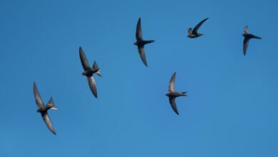
We thought 2025 was a bumper year for curlews, but they are back in even bigger numbers in 2026 and the outskirts of Walshaw Moor are now experiencing what one farmer calls “the overflow”. They are nesting very close to the Pennine Way this year, but the walkers are being brilliant and I hardly ever see a dog off the lead now.

Across Stanbury Bog
Crow Hill summit gives us the view down the most unstable peat on the site. Our analysis of this key area is Chapter 8 p 38 of the Stronger Together response to the PEIR. We made a start in T20 Wuthering Heights and closer study has found unacceptable scientific fraud.


It is a standard application of the technique to float a track across Red Mires Flat, even though there would be much more standing water in the winter. The peat is certainly deep enough, and for the first time I bury the three-metre avalanche pole with no sense of the bottom. It comes out easily too because the peat is completely saturated. What is the point of this track?


An hour after stepping onto the tussocks, we find the ground rising from Middle Moor Flat at last and we are soon at Alcomden Stones. We have done about 1 kph, but conditions were dry, and neither of us would do this on our own. It would be miserable in autumn; every ankle-twisting tussock you fell off would dump you in knee deep bog.
Egal ambushed by Curlew
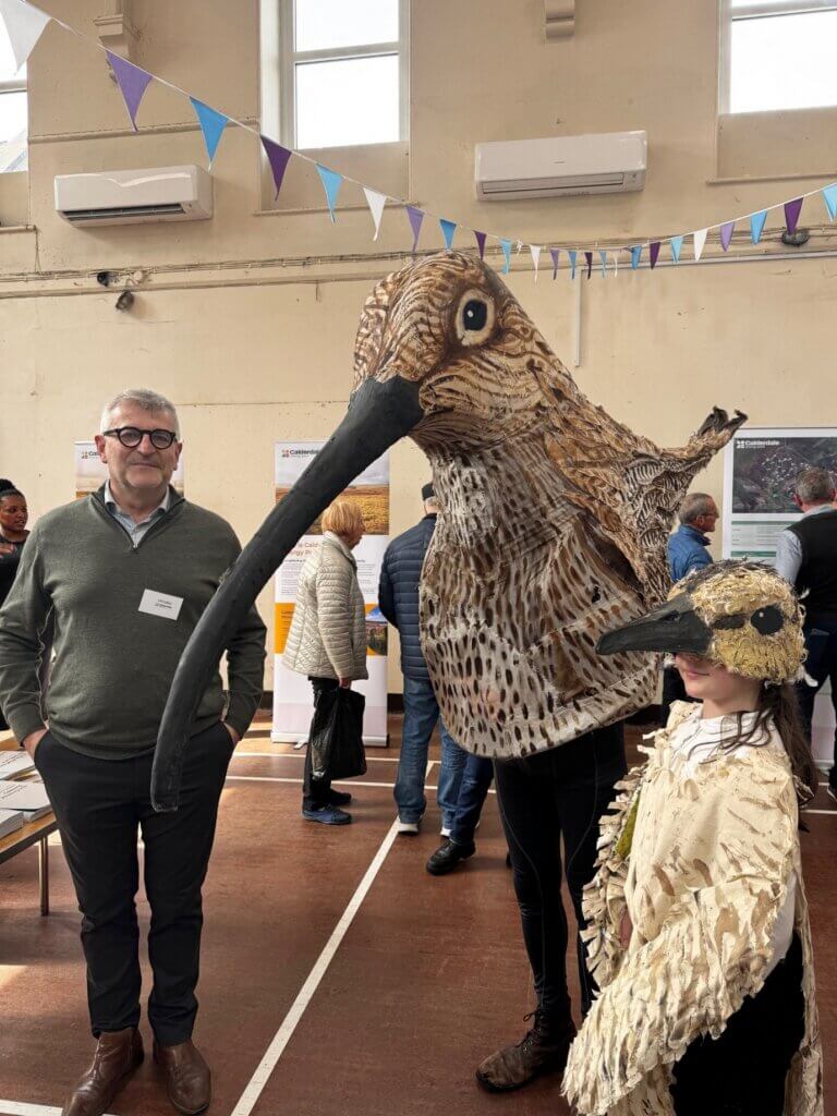
Stronger Together has been responding to the PEIR for the CEP statutory consultation. There have been public consultations around the moor: Denholme was dead; Oxenhope was throbbing; the consultants were depressed at Hebden Bridge and Lydia had arranged for Cathy the Curlew to arrive at Haworth with her chick Cuthbert. Matt Trevelyan is Farming in Protected Landscapes Officer for the Nidderdale National Landscape and as Cathy, has walked the 53 mile Nidderdale Way and done the Yorkshire Three Peaks. Project Director Christian Egal sportingly agreed to have his photo taken.
Christian Egal and Donald Mackay are both very gifted communicators; given a decent site, they know how to get wind farms built too. As I said to them in Haworth, “This turkey of a proposal is waste of your abilities.”
Stanbury Bog Expressway
Donald Mackay enjoys the problem solving. Let’s have another look at his track network.

The infrastructure is magnetically attracted to the very high and high sensitivity habitat. These are the qualifying areas for the SAC designation and the track, hard standings and turbines are right on top. CWF Ltd have taken steps to move the turbine locations off the deep peat to get the CO2 plume smaller, but there is far more to a blanket bog than the carbon it sequestrates. The tracks, turbines, crane hardstanding and cable ducts will destroy the Special Area of Conservation.
The Stanbury Bog Expressway is no exception. This is prime blanket bog, the most extraordinary place of all on Walshaw Moor, and certainly the most frightening. “Expressway” is a more unusual term than I realised. Clydeside Expressway was built partly by the Luftwaffe, partly by a gung-ho Glasgow Corporation, in the intense phase of car worship from 1957-1973 (“You’ve never had it so good” to Sheikh Yamani.) The same phase saw the demolition of the Gorbals and the residents’ relocation to pub-less peripheral estates like Castlemilk. I asked Donald Mackay about his.
NM “Your Expressway is not topologically necessary. You can reach all the turbines without it.”
DM “I need to double up. If I lose the bridge, I can still get across the divide up here.”
Donald Mackay loves the problem solving. Standing next to him at Haworth was a lad, Tom, looked about 16, would be good in a Gillette advert. I thought he was one of Kevin Whitmore’s PR minions, but he was about to give me my favourite moment, easing ahead of the moorland encounter with the Ryles who wanted to take me to the snipe. (“How do you spell it?” “R-Y-L-E.” “Ah! Like the philosopher.” “Yes, he was my uncle.”)
NM (patronising) Are you with Cavendish?
Tom (self-possessed; he can be Prime Minister one day) No. I wrote the birds chapter.
All I could do was shake his hand.
NM You should be very proud. People are saying that Stronger Together paid for it.
This was a cheap shot to cover my utter astonishment that someone so young had mastered both the material and the civil service Mandarin to express it. He will never write a PEIR chapter on a site as interesting as Walshaw Moor again, because nobody will ever attempt a wind farm on somewhere so unsuitable. As Tom (he is TW) himself put it:
“The combination of diverse habitat types, effective predator control, limited disturbance and well-managed vegetation structure has resulted in a site that supports one of the most complete upland bird assemblages in the South Pennines. Populations of SPA/SSSI species remain stable, while a wide range of raptors, waders, owls and passerines also breed successfully.”
Compare Tom’s incisive bird chapter with the vacuous tosh in Biodiversity.
8.8.137 Whilst watercourses would be retained, modification to their alignment and installation of culverts could result in a permanent, medium magnitude of impact, resulting in a significant effect on rivers. However, ongoing work to ensure the use of the least damaging crossing point design and development of appropriate mitigation measures should ensure that the magnitude of the impact could be reduced such that effects would be considered Not Significant.
The nested conditionals “should, could, would” make analysis like nailing jelly to a wall.
Aggregates make the proposal unravel
But in places the PEIR actually has to nail itself to a wall; we can apply the work we have done here since September 2023; and the proposal unravels.
Readers have followed “the aggregates problem” since T54 Bedlam Knoll. The onsite gritstone, and all the gritstone in Lancashire and West Yorkshire, is strong in a block, but too weak, porous and susceptible to frost when crushed to be used for road stone or concrete. The onsite rock on Walshaw Moor can only supply a weak bulk fill. Usually hard limestone is imported from the dales, but it cannot be used on the acid moor because it is a sphagnum poison. It has been clear for two years that vast quantities of granite (or other inert hard stone) would have to be imported. We have published evidence in T33 Roms Hill that CWF Ltd were either ignorant of the aggregate problem, or knew about it but were concealing it, as late as 17 May 2025, during the Non-statutory Consultation. On 21 May 2025, in the broadcast Webinar (43:46) Kevin Whitmore of Cavendish let through the aggregates question and Donald Mackay gave a reply that began: “As you can imagine …” (T21 Pennine Way). No published statement on the aggregates problem was made by CWF Ltd. If their failure to consult 616000 tonnes of granite has to come to court, “As you can imagine” will join “Well, he would, wouldn’t he” and “Let him have it”.
The Scoping Report (September 2025) account of transport was scrambled by 24 road-numbering errors, laid out by Ali West of this parish, and now published on the Planning Inspectorate website. We tried to make sense out of the Scoping Report movements of bulk materials in Turbine 22 Black Clough, finally deciding that the granite would have to come along the M65 through Colne along the sinuous Lancashire Moor road, which would have to be upgraded for the turbine component delivery and upgraded further for two-way movements of aggregate lorries. That blog also observed the conflict of interest for Richard Bannister, who had supplied CWF Ltd with an access route up to Walshaw Moor that would inevitably attract the granite deliveries to Colne and inject them into the notorious traffic jam outside his business at Boundary Mill. The slight mystery was that aggregates seemed also coming from the dales, but we put this down to limestone for concrete, which might be permitted, since concrete is highly alkaline anyway. Nobody could have guessed the utterly absurd source of the granite in the Dales which the Scoping Report flounders around.
The PEIR finally admits the scale of the aggregate problem, which is that 616,000 tonnes of granite and 77,000 tonnes of concrete aggregates (could be limestone) will have to be imported from outside Lancashire and West Yorkshire. There are two tables in the Traffic chapter, giving the lorry movements and the increased traffic count on the road network.

The 3850s are the full and empty granite lorries. The 406s are the concrete aggregates. The aggregate deliveries dominate the traffic. If the aggregates could have been won on site there would have been almost no heavy traffic. The peak is Month 21, with 234 movements per day.
Table 11 gives the sources of the traffic in month 21. Allowing for a rounding error (acknowledged in the PEIR; the numbers are two-way trips and should be even) the 201 (round down to 200) HGVs in row 2 go to the western access via Crow Hill and the 34 in row 6 go to the eastern access via Cock Hill (and are to do with cabling). This 200 + 34 is the 234 from table 10.

The sources of the 234 HGVs are M65 Burnley 74 plus A56 Kelbrook 148 plus A629 Keighley 12 = 234.
But this means that 70% of the granite is coming through the limestone Dales.
The assumption that drives the modelling in Table 11 is stated only in Ch 22 Materials and Waste footnote 48, given here as a screenshot for subsequent evidential purposes.

The PEIR assumption that explains the traffic flows in Table 11 is that 70% of the granite is imported into the dales by rail to Horton-in-Ribblesdale, and is then loaded onto lorries in 20 tonne loads and brought out of the dales to the site. Only 30% goes to Leyland (the former British Leyland sidings at junction 1 of the M65) and along the M65 through Colne to the site. This “Horton” assumption is utter nonsense.

The stone handling at Horton-in-Ribblesdale on the Settle-Carlisle railway is consented and configured for export only. “Horton” is not a receiving depot for aggregates; its purpose is the export of Horton Quarry limestone by rail. The Network Rail announcement of the reopening of rail export on 15 July 2025 from Horton-in-Ribblesdale says:
“The re-linked rail terminal will move about 1,600 tonnes of limestone from the quarry every weekday on the railway instead of on lorries. This will help save more than 507 tonnes of CO2 each year and keep the roads clearer. Plus, the rail link will help boost the local economy by safeguarding jobs at the quarry. The local government plans to reduce road haulage through the region – so the quarry might have had to close without the link. And the link will help the building industry that relies on much of the stone coming from the quarry.”
Objective D4 of the YDNP Management Plan 2019-2024 was:
“Create a railhead at Horton Quarry and continue other measures to reduce road haulage limits from quarries by 50% compared to 2011.”
The stated purpose of the facilities at “Horton” is thus to reduce export by lorry through the Dales. It is entirely counter to this purpose to import alien hard stone to “Horton” by rail and then export it by lorry. There is no unloading equipment, nor stockpile pads nor HGV aprons at Horton-in-Ribblesdale.
There would be infinite planning objections to converting and then using Horton-in-Ribblesdale as a receiving depot for export by lorry, in direct inversion of its consented purpose, and this matter has never been put to consultation by CWF Ltd nor is there any record of discussions between CWF Ltd and YDNPA, Network Rail or Heidelberg. There is a full analysis in the Stronger Together response to the PEIR chapter 14.
And 616,000 tonnes of granite through Colne is utterly unconsulted
All the granite will have to go to Leyland which is a receiving depot; all of it must come through Colne past Richard Bannister’s Boundary Mill, and there has been not a word about this matter at the four consultations since inception.
Inception (11 November 2021) Christopher Wilson and Algihaz enter an agreement with Richard Bannister. Due diligence fails to discover the aggregate problem. Richard Bannister would have told them if he had been asked because his gamekeepers scrupulously use blue granite to repair tracks.
Natural Power Scoping Report (September-October 2023): onsite rock from borrow pits supplemented by stone from quarries east of the site
Collapse of CWF proposal (October 2024) follows letter from NM asking technical team about the aggregates
Non-statutory consultation (29 April-6 June 2025): no change in all publications; consultants ignorant of the aggregate problem on 17 May 2025
Dr Ghazi Osman ceases to be a person of significant control (19 May 2025). CWF Ltd now has an empty PSC register, prima facie a criminal offence against the Companies Act (2006) with a maximum sentence of two years.
Donald Mackay (Webinar question 21 May 2025) “As you can imagine …”
Logika Scoping Report (1-29 September 2025): no statement about hard stone; scrambled road labels; mysterious aggregates seem to come from the limestone dales. No rational reader could tumble to the assumption that the granite is sent by rail to Horton-in-Ribblesdale.
PEIR (8 April – 10 June 2026): 616,000 tonnes of hard stone, 70% imported to “Horton” and 30% to Colne, but it all has to go to Boundary Mill and as you see, it has not been consulted.
We are in a process phase: proper consultation is critical to the DCO being accepted for examination when it is submitted. Failure to consult Colne about 616,000 tonnes of hard stone deliveries should be fatal, both to acceptance of the DCO application in November, and to the investor’s confidence in the proposal.
Christopher Wilson bumbled onto Walshaw Moor in 2021, and Richard Bannister has taken him to the cleaners.
++++++++++++++++++++++++++++++++++++++++++++++++
This is the 58th in a series of guest blogs originally based on the 65 wind turbines which Richard Bannister planned to have erected on Walshaw Moor.
The developers canned their original 65 wind turbines, quite possibly in response to the public humiliation of having their so-called ‘plan’ publicly shown to be damaging, irrational and probably unlawful. They came back with a plan for 42 wind turbines and the amazing Nick MacKinnon and friends ridiculed that so-called plan. Now the developers have brought forward a 34-turbine revision – the series continues.
To see all the blogs – click here.
[registration_form]
Source link